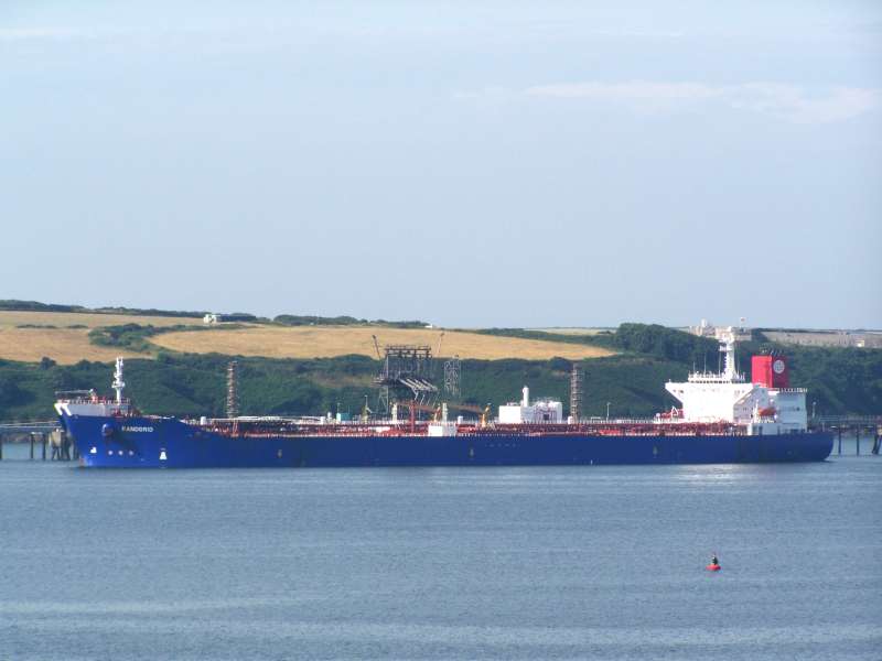
RANDGRID🇧🇸

MooredOther
0.0 ktsSpeed
Course
4.6mDraught
Trip InformationAll times in UTC
Live Position & RouteLast updated: Loading...
SETUBAL
🇵🇹PTSET
UK Coast & Atlantic
ATD
Loading...
Loading...
>>>>>>>>>
SETUBAL
🇵🇹PTSET
UK Coast & Atlantic
ETA
Loading...
Loading...
Loading map...

Photo Gallery

RANDGRID MMSI 311038200
📸 Ian Thomas

Specifications

Dimensions

Length265.88m
Breadth46m
Max DraughtN/A

Capacity

Gross Tonnage76824 GT
Deadweight124502 DWT
TEUN/A

Performance

Max Speed1 kn
Avg Speed0.2 kn

Build Info

Year Built1995
Home PortNASSAU

Description

Loading vessel information...

Track Analytics

Loading track data...

Identification

MMSI311038200
IMO9075345
Call SignC6YM8
Flag State🇧🇸 Bahamas (BS)

Current Position

Latitude38.471809° N
Longitude8.791652° W

Navigation Status

StatusMoored
Speed0.0 kts
Course
Heading
DraughtN/A

Port Terminals

SETUBALDeparture Port

APSSMULTI PURPOSE TERMINAL 1 - TERSADO
ADMINISTRACAO DOS PORTOS DE SETUBAL E SESIMBRA
Terminal Multiusos do Porto de Setúbal, Zona 1, Av. Baía de Setúbal, 2910-793 Setúbal, Portugal
38.518889, -8.880278
Visit Website
SADOPMULTI PURPOSE TERMINAL 2 - SADOPORT
SADOPORT - TERMINAL MARITIMO DO SADO S.A.
Terminal Multiusos do Porto de Setúbal, Zona 2, Av. Baía de Setúbal, 2910-793 Setúbal, Portugal
38.513889, -8.871944
Visit Website

SETUBALDestination Port

APSSMULTI PURPOSE TERMINAL 1 - TERSADO
ADMINISTRACAO DOS PORTOS DE SETUBAL E SESIMBRA
Terminal Multiusos do Porto de Setúbal, Zona 1, Av. Baía de Setúbal, 2910-793 Setúbal, Portugal
38.518889, -8.880278
Visit Website
SADOPMULTI PURPOSE TERMINAL 2 - SADOPORT
SADOPORT - TERMINAL MARITIMO DO SADO S.A.
Terminal Multiusos do Porto de Setúbal, Zona 2, Av. Baía de Setúbal, 2910-793 Setúbal, Portugal
38.513889, -8.871944
Visit Website

Frequently Asked Questions

Where is RANDGRID right now?

According to the latest AIS signal, RANDGRID is currently located at 38.4718°N / 8.7917°W. The vessel is currently not moving. You can follow the live position on the tracking map above.

Where is RANDGRID sailing to?

RANDGRID is currently sailing to SETUBAL (Portugal), with an estimated time of arrival of Sun, 24 Aug 2025 11:46:00 GMT. The vessel departed from SETUBAL.

What kind of ship is RANDGRID?

RANDGRID is a vessel sailing under the flag of Bahamas. It is 265.88 meters long with a beam of 46 meters and was built in 1995.

What is the MMSI and IMO number of RANDGRID?

The MMSI (Maritime Mobile Service Identity) of RANDGRID is 311038200. Its IMO number is 9075345. The vessel's call sign is C6YM8.

How can I track RANDGRID live?

You can track RANDGRID in real time on Ships25 using AIS data. The tracking map shows the current position, historical route with playback, speed, heading and draught. Position data is updated continuously while the vessel is within AIS coverage.