SEA LIGHT🇿🇿

MooredTanker
0.0 ktsSpeed
Course
3.1mDraught
Trip InformationAll times in UTC
Live Position & RouteLast updated: Loading...
CRISTOBAL ANCH
🌍
ATD
Loading...
Loading...
>>>>>>>>>
CARTAGENA
🇨🇴COCTG
North Coast South America
ETA
Loading...
Loading...
Loading map...

Photo Gallery

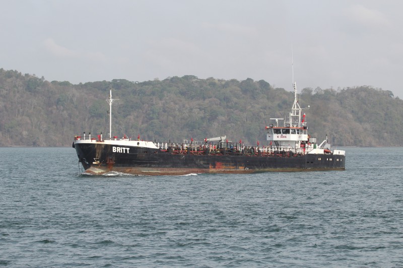
SEA LIGHT MMSI 352670000
📸 Pascal Bredel

Specifications

Dimensions

Length85.86m
Breadth11.33m
Max DraughtN/A

Capacity

Gross Tonnage1471 GT
Deadweight2235 DWT
TEUN/A

Performance

Max SpeedN/A
Avg Speed0.1 kn

Build Info

Year Built1979
Home PortN/A

Description

Loading vessel information...

Track Analytics

Loading track data...

Identification

MMSI352670000
IMO7910876
Call SignN/A
Flag State🇿🇿 Unknown Region (ZZ)

Current Position

Latitude10.364530° N
Longitude75.510880° W

Navigation Status

StatusMoored
Speed0.0 kts
Course
Heading511°
DraughtN/A

Port Terminals

CARTAGENADestination Port

CTGTMCOMPANIA DE PUERTOS ASOCIADO (COMPAS)
COMPANIA DE PUERTOS ASOCIADO (COMPAS)
Avenida Pedro Vélez 48-14, Barrio el Bosque, Cartagena, Bolívar, Colombia
10.398889, -75.528333
Visit Website
SPRCSOCIEDAD PORTUARIA REGIONAL DE CARTAGENA (SPRC)
SOCIEDAD PORTUARIA REGIONAL DE CARTAGENA (SPRC)
Manga Sea Terminal, Cartagena, Bolívar, Colombia
10.405833, -75.534167
Visit Website
TCCTERMINAL DE CONTENEDORES DE CARTAGENA (CONTECAR)
TERMINAL DE CONTENEDORES DE CARTAGENA (CONTECAR)
Via Mamonal Kilometro 1, Cartagena 130013, Bolívar, Colombia
10.376389, -75.510000
Visit Website

Frequently Asked Questions

Where is SEA LIGHT right now?

According to the latest AIS signal, SEA LIGHT is currently located at 10.3645°N / 75.5109°W. The vessel is currently not moving. You can follow the live position on the tracking map above.

Where is SEA LIGHT sailing to?

SEA LIGHT is currently sailing to CARTAGENA (Colombia), with an estimated time of arrival of Mon, 20 Sep 2021 15:36:00 GMT. The vessel departed from CRISTOBAL ANCH.

What kind of ship is SEA LIGHT?

SEA LIGHT is a tanker sailing under the flag of Unknown Region. It is 85.86 meters long with a beam of 11.33 meters and was built in 1979.

What is the MMSI and IMO number of SEA LIGHT?

The MMSI (Maritime Mobile Service Identity) of SEA LIGHT is 352670000. Its IMO number is 7910876.

How can I track SEA LIGHT live?

You can track SEA LIGHT in real time on Ships25 using AIS data. The tracking map shows the current position, historical route with playback, speed, heading and draught. Position data is updated continuously while the vessel is within AIS coverage.